
BMRDA Road Grid for Bengaluru Urban: What Plot Owners and Buyers Must Check
Karnataka has notified a road grid for Bengaluru Urban areas outside the GBA, with corridors to be kept vacant for future roads. Here is what was announced, and how to check whether your plot is affected.
.png)
On September 29, 2026, Bengaluru Development Minister Krishna Byre Gowda announced that the government has notified a new road grid for areas of Bengaluru Urban district outside the Greater Bengaluru Authority (GBA). Identified through a drone survey and marked in the master plans of BMRDA and other planning authorities, the grid is meant to put roads in place before layouts and buildings come up. Owners are asked to leave notified corridors vacant.
Key takeaways
- A road grid has been notified for Bengaluru Urban areas outside the GBA, covering hundreds of roads.
- The grid links taluk and hobli centres, district roads, state highways, the Peripheral Ring Road and the Satellite Town Ring Road.
- Full construction could take five to ten years, but land for the corridors must be left vacant in new layouts and houses.
- The government says building on notified land violates the law.
- The minister said the notification does not immediately take land; money is needed only when a road is built.
- The list of affected properties is to be on the BMRDA website and at panchayat and revenue offices. Check it before you buy or build.
For years, Bengaluru's outskirts have grown plot by plot, with roads squeezed in afterwards. The new road grid tries to reverse that order: mark the roads first, then let development follow. For anyone holding or eyeing land on the fringe, it adds a new question to the usual checks: is my parcel on a future road?
What Was Announced
According to reports of the minister's briefing, the government has notified the road grid for areas of Bengaluru Urban district that lie outside GBA limits. Hundreds of roads are included, with widths reported up to 90 metres, and they are designed to connect taluk and hobli headquarters, major district roads, state highways, the Peripheral Ring Road and the Satellite Town Ring Road. They are notified as CDP roads in a grid pattern to support planned expansion.
| Detail | As reported |
|---|---|
| Announced by | Bengaluru Development Minister Krishna Byre Gowda |
| Date | September 29, 2026 |
| Coverage | Bengaluru Urban district areas outside the GBA |
| How identified | Drone survey, marked in BMRDA and local authority master plans |
| Scale | Hundreds of roads, widths reported up to 90 metres |
| Build timeline | Five to ten years for complete construction |
| Rule for owners | Leave notified corridors vacant when building houses or layouts |
| Compensation timing | Money needed only when a specific road is taken up, per the minister |
| Where to check | BMRDA website, panchayat and revenue offices |
Why the Government Is Doing This
The minister said Bengaluru grew rapidly over the past 25 years without enough advance planning, and that daily traffic congestion is the result. By reserving corridors early, the state wants to avoid repeating that on the fringe, where urbanisation is spreading fast. He noted that while Bengaluru itself covers roughly 750 sq km, around 1,200 sq km beyond it already has an urban character.
The push also comes with a wider infrastructure theme: the entire Bengaluru Urban district was recently brought under the Bangalore Water Supply and Sewerage Board's jurisdiction, and the stated goal is to back future growth with roads, drinking water and drainage.
.pngg)
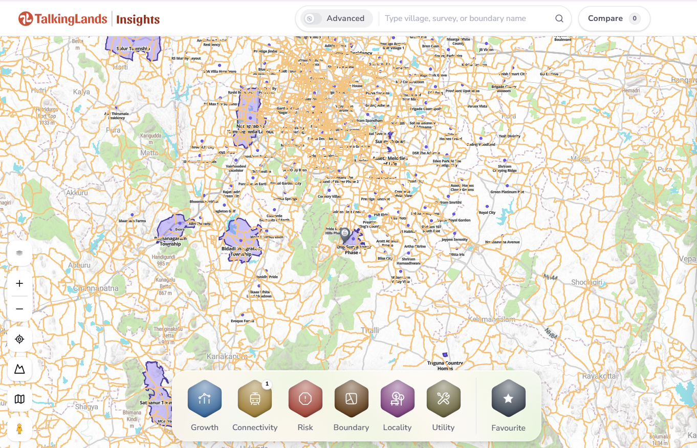
Bengaluru's outskirts on TalkingLands Insights. Click to explore roads and parcels.
What Owners and Buyers Need to Know
- Corridors must stay vacant. If part of your land falls on a notified road, new houses or layouts cannot use that strip.
- Building on it is a legal risk. The government has said construction on notified land is a violation, so structures there could be a problem later.
- No immediate takeover, but no certainty either. The minister said payment is needed only when a road is built. Reports also say some owners may eventually have to relinquish land, so plan for it.
- Timeline is long. Five to ten years means the restriction bites now, while the road itself may be years away.
- Layout buyers should ask developers. Ask how much of a layout falls in a notified corridor, and how it was handled in approvals.
The balanced view: in the long run, planned road networks can lift connectivity and the value of land near them. In the short run, they can shrink what you can build on a parcel. Which side you land on depends on where the line runs.
Which Areas Are in Focus
The notification targets areas that are currently developing outside GBA limits, the outer taluk and hobli belts of Bengaluru Urban district. These are the places where layouts are multiplying and where the minister says roads are most needed before growth takes shape. It does not apply to areas inside the GBA.
If you are looking at land in a developing outer pocket, treat the road grid as a standard due-diligence item, alongside title, khata and land-use conversion.
How to Check on TalkingLands Insights
- 1. Search the location or survey area you are considering.
- 2. Open Boundary on the parcel to see its shape and position on the map.
- 3. Turn on Connectivity to see the roads and transit around it.
- 4. Add Locality and Growth layers to understand how the surroundings are developing.
- 5. Match it to the official list on the BMRDA website or at the panchayat and revenue office, and confirm with a property lawyer.
Insights helps you see the parcel and the roads around it. The authoritative answer on whether a specific survey number is notified still comes from the official list.
Boundary and Connectivity layers on a parcel. Click to try it.
Common Mistakes on the Outskirts
- Not checking the notified road list: do it before you pay an advance, not after registration.
- Assuming an approved layout is automatically clear: ask how the notified corridors were treated.
- Building the compound wall first: a wall or structure on a notified strip can become a liability.
- Ignoring road width: a wide notified road beside your plot changes both what you can build and what the area will feel like.
- Relying on hearsay: alignments are on the official list, not in a broker's promise.
The road grid is a sign that Bengaluru's fringe is being planned earlier than before. Locate your parcel, check it against the notified corridors, and confirm the records, so the road is a benefit rather than a surprise.
Check any outskirts plot before you buy
See the parcel boundary and the roads around it on one map and pull a property report. Sign up free and get 5,000 coins.
Check my plot freeFrequently asked questions
The government has notified a new road grid for areas of Bengaluru Urban district outside the Greater Bengaluru Authority (GBA). Bengaluru Development Minister Krishna Byre Gowda announced it on September 29, 2026, saying the aim is to plan roads before layouts and homes fill the outskirts.
No. It covers areas of Bengaluru Urban district outside GBA limits, identified in the master plans of BMRDA and other local planning authorities.
The minister said the notification does not immediately take land from owners and that money is needed only when a particular road is taken up for construction. Reports also say some owners may eventually have to relinquish land for roads, so check the alignment against your property.
The government has asked owners to leave notified road corridors vacant when building houses or layouts, and has said that building on such land would violate the law. Confirm the exact rule for your parcel with the authorities.
Look up the notified list on the BMRDA website, or at panchayat and revenue offices as the minister has said it will be made available. On TalkingLands Insights you can view a parcel's boundary and the roads around it, then verify against the official list and with a property lawyer.
Disclaimer: This article is general information as of September 2026, based on media reports of the minister's announcement. It is not legal or investment advice. Alignments, widths, rules and timelines are set by the government and BMRDA and can change. Verify the official notification for your survey number and confirm records with Bhoomi and a qualified lawyer before buying or building.
.png)


