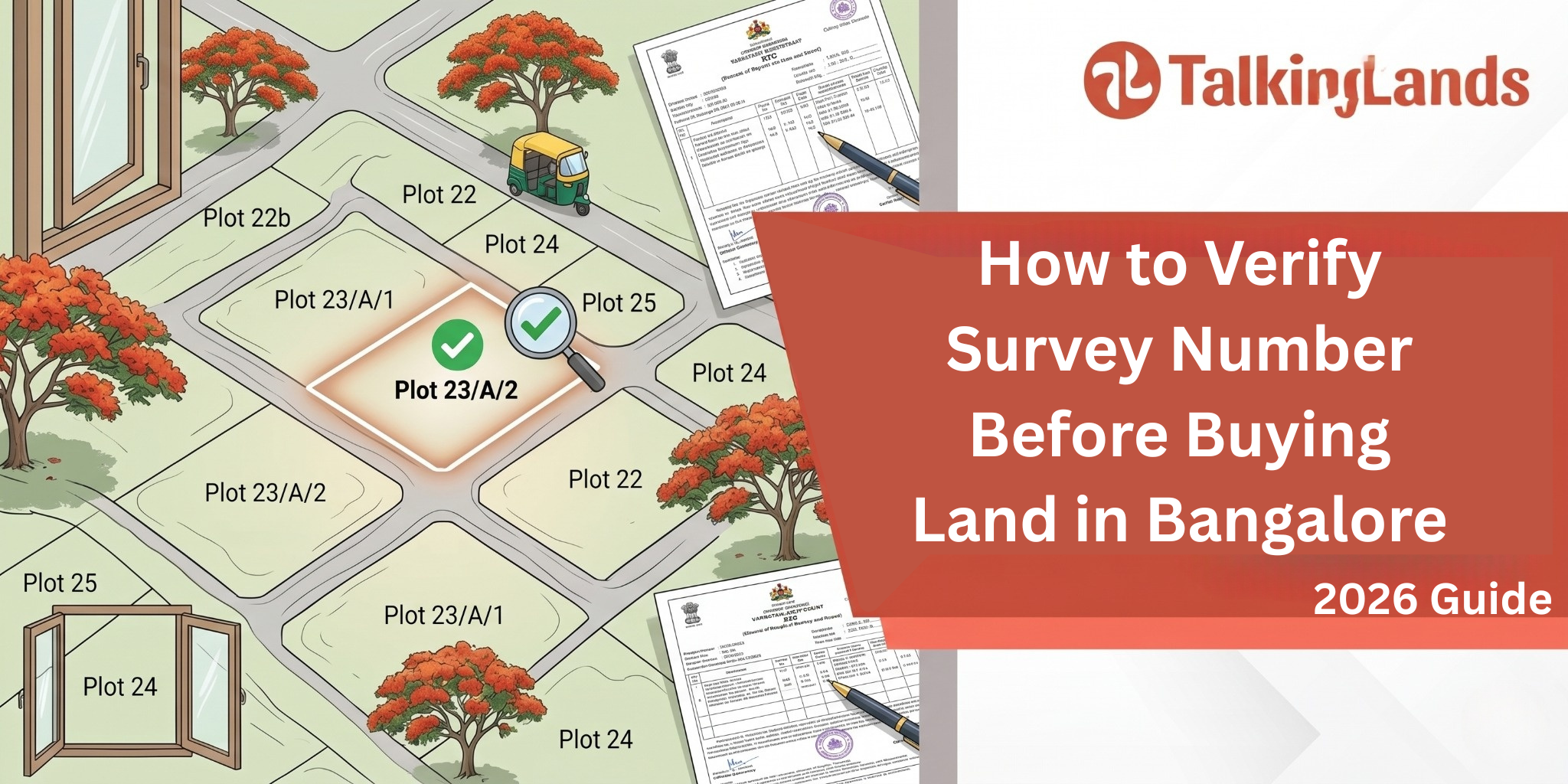
How to Verify Survey Number Before Buying Land in Bangalore (2026 Guide)
The single most important number on any Bangalore land document is the survey number. It is the official identifier the Karnataka revenue department uses to track every parcel of land — older than the title deed, more permanent than the address, and the foundation on which every other land record is built.
If the survey number on the sale agreement does not match the actual physical land you are buying, nothing else in the deal matters. The title can be clean, the EC can be clear, the RERA registration can be valid — and you can still end up owning a different piece of land than the one you thought you were buying.
This guide explains exactly what a survey number is, the documents that reference it, the common ways survey numbers go wrong in Bangalore land deals, and the step-by-step process to verify any survey number before you sign anything.
What is a Survey Number?
A survey number is the unique identifier assigned by the Karnataka revenue department to every parcel of agricultural and revenue land. It originates from the Karnataka Land Revenue records — historically maintained at the village level by the village accountant, now digitised on the Bhoomi portal and the more recent Dishaank GIS system.
The full survey number for a piece of land in Karnataka typically has three or four parts:
The base survey number: The primary identifier, like "Survey No. 47" within a specific village.
The hissa number or sub-division: When a survey number is divided among multiple owners or for multiple uses, sub-divisions are created, like "Survey No. 47/2" or "Survey No. 47/2A".
The village name: Survey numbers are unique only within a village. Survey No. 47 in Whitefield village is completely unrelated to Survey No. 47 in Varthur village.
The hobli, taluk, and district: Administrative units that locate the village in the broader revenue hierarchy.
A complete reference might read: "Survey No. 47/2A, Hope Farm Village, Krishnarajapuram Hobli, Bangalore East Taluk, Bangalore Urban District."
For agricultural land conversions to non-agricultural use (NA / DC converted plots), the survey number remains the master identifier even after conversion. For sites carved out of layouts approved by BDA, BBMP, or local panchayats, the original survey number is still referenced in the title chain.
Why Survey Number Verification Matters
Three categories of problems make survey number verification essential:
Mismatch between document and reality: The most common Bangalore land fraud — sometimes deliberate, sometimes a genuine error — is selling a piece of land where the survey number on the sale deed does not actually match the physical plot. The buyer sees one piece of land, signs documents referring to a different survey number, and only discovers the mismatch when trying to construct or register.
Sub-division confusion: When Survey No. 47 is divided among siblings into 47/1, 47/2, and 47/3, the boundaries between these sub-divisions are sometimes informal. The seller may believe they own 47/2 entirely, but the official sub-division records may show different boundaries. Without verification, you can buy 47/2 and discover that part of what you thought you bought is actually 47/1 belonging to a different family.
Historical revenue disputes: Some Bangalore villages had unsettled revenue records for decades — the same survey number was claimed by multiple parties under different revenue inheritances. Apparent clear titles can conceal underlying disputes that surface during construction or resale.
Conversion status uncertainty: A plot may be sold as "DC converted" — meaning agricultural land has been formally converted to non-agricultural use. But the conversion order is tied to a specific survey number. If the seller's papers reference one survey number but the conversion order references a different one, the conversion does not apply to the land you are buying.
Documents That Reference the Survey Number
Several Karnataka land documents carry the survey number, and each tells you something different.
Record of Rights (RTC), also called Pahani: This is the primary revenue record for agricultural and revenue land. It shows the survey number, the area, the cultivator, the land class, and the revenue payable. RTCs are downloadable from the Karnataka Bhoomi portal.
Mutation Register (MR): This records every change in ownership of a survey number — sales, inheritances, partitions, gifts. The MR is the chain of ownership for revenue purposes and complements the title deed chain.
Index of Lands (Akarbandh): This older record links the survey number to detailed land use, area, and boundary information at the time of original survey settlement.
Tippani / Padodi: Sketch documents showing the shape and boundaries of a survey number.
11E Sketch: A cadastral sketch that shows the boundaries of a survey number relative to its neighbours.
Conversion Order: For converted land, the DC's order specifies the survey number, the area being converted, the converted use, and the conditions.
Khata: While khata is technically a property tax record (separate from revenue records), it cross-references the survey number for properties on agricultural-origin land. A and B khata distinctions affect what construction is permitted.
For a typical Bangalore land transaction, you will see the survey number on the sale agreement, the absolute sale deed, the EC, the RTC, the MR, the Khata extract, and the Conversion Order. All of these should agree on the same survey number, the same area, and the same boundaries. Any inconsistency is a red flag.
Verifying a survey number properly involves cross-checking the same number across multiple independent sources. Here is the practical sequence:
Get the exact survey number from the sale agreement: Note the base number, hissa, village, hobli, and taluk. The full reference matters — partial references can match different plots in different villages.
Pull the latest RTC for the survey number: Use the Bhoomi portal (landrecords.karnataka.gov.in) and search by district, taluk, hobli, village, and survey number. The RTC tells you who is currently shown as the cultivator/owner in revenue records, the area, and the land class.
Verify the seller is the RTC holder: The person you are buying from should be named in the RTC. If they are buying from someone else who is in the RTC, you need a power of attorney chain or the original RTC holder's involvement in the transaction. This is where a lot of Bangalore land disputes originate.
Pull the Mutation Register for the chain of past ownership: Verify that the title chain in the sale deeds matches the mutation chain in the MR. Discrepancies between title transfers and mutation entries indicate that someone in the chain skipped registration with the revenue department — a fixable but flag-worthy issue.
Verify the area and boundaries against the Tippani or 11E sketch: The area shown in the RTC should match the area in the sale agreement. The boundaries should match what you see on the ground.
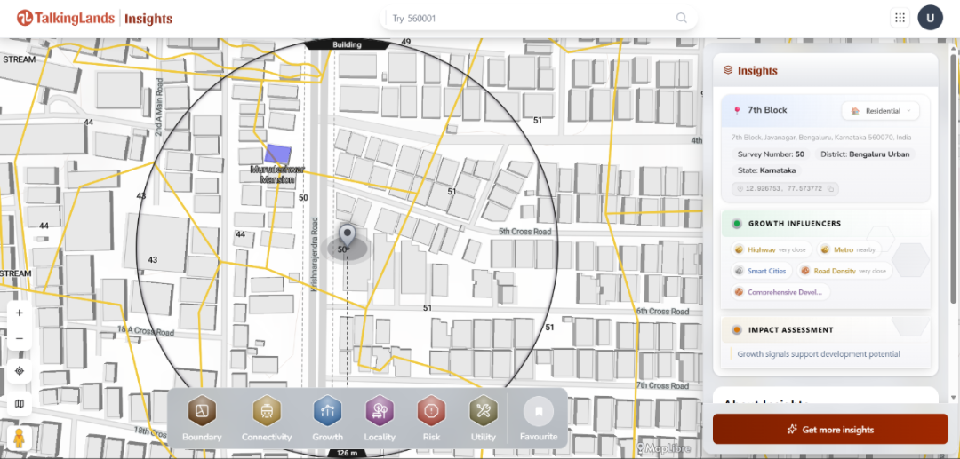
Cross-check with TalkingLands' parcel map: This is the new step that has dramatically simplified verification. TalkingLands' platform overlays survey numbers across all of India on its base map. You can search the survey number, see the polygon on the satellite image, and verify that the shape and location match what the seller is showing you.
For converted land, pull the Conversion Order separately: The order should reference the same survey number, the same area, and the same converted use described in the sale agreement.
For layout plots, verify the parent survey number: Even for plots in approved layouts, the original survey number is referenced in the title chain. Verify that the layout was approved on a survey number that the developer legitimately owned or had development rights on.
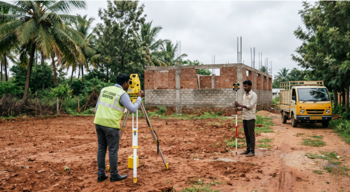
Get a survey done by a licensed surveyor: For high-value land purchases, a physical survey by a licensed Karnataka surveyor matches the documentary evidence to actual ground measurement. This is the final layer of verification.
Common Survey Number Problems in Bangalore Land Deals
Several specific issues recur in Bangalore land transactions. Knowing them helps you spot trouble early.
The "joint survey number" problem: A single survey number is jointly held by multiple family members but only one of them has signed the sale agreement. Even if their share is genuine, the sale is incomplete without the others. Always verify that all RTC holders are party to the transaction.
The "ancestral partition without registration" problem: Family partitions are often informal — the brothers verbally agreed who got which portion of the survey number, but no formal partition deed was registered. The RTC may still show all brothers as joint holders even though physically they each occupy distinct portions. Selling such land requires regularising the partition first.
The "GPA holder selling without principal" problem: Some Bangalore land deals are structured through general powers of attorney where the GPA holder sells the land and the original owner is not directly involved. After the 2011 Supreme Court ruling in Suraj Lamp & Industries v. State of Haryana, GPA-based sales are not valid title transfers. Always insist on the principal's involvement and a registered sale deed.
The "agricultural land sold as residential" problem: A survey number may be agricultural in revenue records but is being marketed and priced as residential. Without formal DC conversion, no residential construction is permitted. Verify the conversion order tied to the specific survey number, not just the broader area.
The "multi-tongued boundary description" problem: Older sale deeds describe boundaries in vague natural-language terms ("east: Krishnappa's coconut tree, west: the foot path"). When such descriptions are inherited into modern transactions, the actual physical extent of the land becomes ambiguous. Always insist on a current sketch with measurable boundaries.
The "double registration" problem: In rare but documented cases, the same survey number has been sold to multiple buyers by colluding intermediaries. Always pull the latest EC immediately before registration, not weeks earlier — recent transactions can change what is legally available to be sold.
TalkingLands maintains a proprietary parcel-level dataset covering survey numbers across all of India — the largest such consumer-accessible dataset in the country. This data is free to access on the platform.
For any survey number in Bangalore, you can:
Search by survey number, address, or property name. The corresponding parcel polygon appears on the satellite map.
Verify that the polygon matches what the seller is showing you on the ground. A common fraud is when the seller's "land" on the ground is not the same shape as the survey number on paper.
Toggle Boundary layers — Village Map, Sub-District, Planning Authority Maps — to verify the survey number sits in the correct administrative unit.
Toggle the CDP layer to verify the zoning of the actual survey number, not the broader area.
Toggle Risk layers — Rajakaluve, lake buffer, flood index, protected area — to check if the specific survey number falls in any restriction zone.
Generate a Property Report consolidating the location verification along with regulatory checks.
The survey number access on TalkingLands is free — no subscription, no per-search fee. Premium layers (CDP, Risk, Connectivity) are token-based, with the entry-level Property Report priced at ₹100.
This is genuinely the cheapest first-line verification available for Indian land. A licensed surveyor visit costs ₹5,000 to ₹15,000. A revenue department visit costs the time and the unofficial fees. The TalkingLands first check costs nothing and takes thirty seconds.
It is not a substitute for the legal verification — you still need to pull the RTC, the MR, the EC, and have a property lawyer review the title chain. But as the first line of defence, before you spend any money on advanced due diligence, it stops the obvious problems.
What is a survey number in Karnataka land records? A survey number is the unique identifier assigned by the Karnataka revenue department to every parcel of agricultural and revenue land. It is referenced in all major land documents including RTC, mutation records, sale deeds, and conversion orders.
How do I find the survey number for a property in Bangalore? The survey number is on the title deed, sale agreement, RTC, and EC for the property. If you do not have these documents, you can search by address on TalkingLands and the corresponding survey number is shown.
Can a survey number be split into sub-divisions? Yes. When a survey number is divided among multiple owners or for different uses, sub-divisions (hissa numbers) are created. A common reference would be "Survey No. 47/2" where 2 is the hissa within Survey No. 47.
What is the difference between RTC and survey number? The survey number is the identifier; the RTC (Record of Rights, Tenancy and Crops) is the document that records information about that survey number — current cultivator, area, land class, and revenue. Every RTC is for a specific survey number.
Is the survey number the same as the khata number? No. The survey number is the revenue department identifier for the land. The khata number is the property tax identifier maintained by the local body (BBMP for Bangalore). Both reference the same property but serve different administrative purposes.
How can I verify a survey number for free? The Karnataka Bhoomi portal lets you pull the RTC for any survey number. TalkingLands' platform lets you visualise the survey number's actual polygon on a satellite map, free. Combining the two gives you the basic first-line verification at zero cost.
What happens if the survey number on the sale deed is wrong? If the survey number on the sale deed does not match the actual physical land, the sale is fundamentally flawed. The buyer is paying for one piece of land but legally entitled to a different one. Such errors must be rectified through formal registration of a corrected deed before the transaction can be considered valid.
Do I need a survey number for an apartment in Bangalore? Yes — every apartment is on land that has a survey number. The apartment's title chain references the original survey number of the parent plot. Even for buyers of completed apartments, the parent survey number's clean status matters for the apartment's legal foundation.


.png)
.png)
.png)
