Anekal Master Plan Map: How to Check Your Plot’s Zone and Planning Authority
Buying land or a home around Anekal, Sarjapura, Attibele or Jigani? The zone on the Anekal master plan and the planning authority that approves your layout decide what you can legally build. Here is how to read the Anekal CDP map and check any plot, step by step.
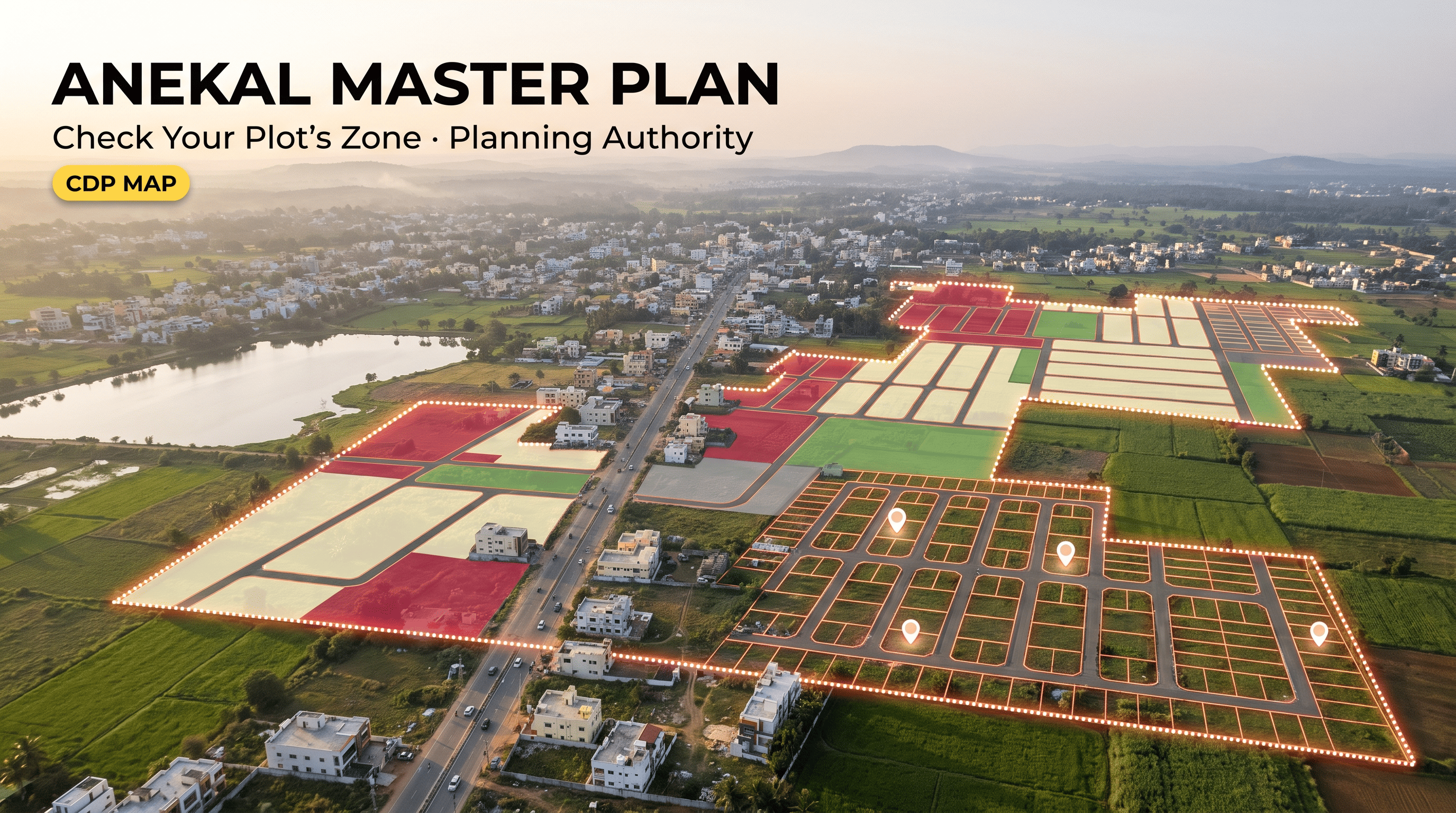
The Anekal master plan is the statutory land-use plan for the Anekal Local Planning Area south of Bengaluru, prepared with a 2031 horizon. It assigns each stretch of land a zone, such as residential, commercial, industrial, public and semi-public, agricultural or green belt, and the Anekal planning authority approves layouts and buildings within that framework. People often search for it as the Anekal CDP map. Checking your plot’s zone and its planning authority is the first step before you buy.
Key takeaways
- The Anekal master plan (often searched as the Anekal CDP map) sets the zone for land in the Anekal Local Planning Area, with a 2031 horizon.
- The zone decides what can be built; the Anekal planning authority is the body that approves layouts and buildings under the plan.
- Reporting describes four planning districts in the area: Anekal, Sarjapura, Attibele and Jigani.
- A map layer helps you locate a plot’s zone quickly, but the notified plan and the planning authority’s record are what you rely on.
- The master plan does not prove ownership. Check title and the RTC separately.
- On TalkingLands Insights, the Boundary category shows the Master Plan and Planning Authority Maps layers over the parcel.
Anekal has become one of the busiest land and housing markets on the southern edge of Bengaluru, helped by its closeness to Electronics City, Sarjapura Road, Attibele and the Tamil Nadu border. Demand brings a familiar problem: two plots a short distance apart can sit in very different zones, fall under different rules and carry very different risks. That is why searches for the Anekal master plan, the Anekal CDP map and the Anekal planning authority keep rising. This guide explains what each term means and how to check a specific plot before you pay a token amount.
What the Anekal master plan and CDP map are
A master plan is the legal document that says how land in a planning area is meant to be used over a set period. For Anekal, the plan is prepared for the Anekal Local Planning Area under the Karnataka Town and Country Planning Act, and its horizon year is 2031. It has two parts that matter to a buyer: a map showing land-use zones and a set of zoning regulations that spell out what is allowed in each zone.
You will also see the same idea called a CDP, short for Comprehensive Development Plan. In everyday Karnataka usage, the Anekal CDP map and the Anekal master plan map point to the same thing: the zoning map for the planning area. When you want to know “what is my plot zoned as?”, this is the document that answers it.
Reporting on the plan describes four planning districts within the area: Anekal, Sarjapura, Attibele and Jigani. These are planning units, not single villages, so a district can contain many villages and survey numbers. The plan was built on a land-use survey and reportedly retains approved layouts and earlier land-use changes, which is one reason the ground reality can differ from a quick glance at a map.
Who is the Anekal planning authority
The Anekal planning authority is the local planning authority for the Anekal Local Planning Area. It works inside the wider Bengaluru Metropolitan Region framework, which is overseen by BMRDA. In simple terms, the regional body sets the broad framework, and the local planning authority handles day-to-day planning approvals within it, including layout approvals and building plan clearances in its limits.
For a buyer, the practical point is this: a layout is only as good as the approval behind it. Ask which authority approved the layout, under which order and on what date, and ask for the sanctioned plan. The jurisdiction of a planning authority and of the local urban body can differ, and limits get revised, so confirm which body covers your village instead of assuming.
Zones and what they mean for you
Each plot in the planning area falls into a land-use zone. The exact list and rules sit in the zoning regulations, so read them for your plot. The table below gives a plain-language view of how the commonly used zones affect a buyer. Treat it as a guide to the questions to ask, not as legal advice.
| Zone type | What it generally signals | What to check |
|---|---|---|
| Residential | Intended for housing and related uses | Layout approval, road width, building rules for the zone |
| Commercial | Intended for shops, offices and mixed commercial use | Permitted uses, parking and frontage rules |
| Industrial | Intended for industry and allied uses | Nearby pollution or buffer rules, homes may not be intended |
| Public and semi-public | Reserved for schools, hospitals and civic uses | Whether private housing is permitted at all |
| Agricultural | Intended for farming; building is restricted | Conversion status and whether the plot can be developed |
| Green belt or conservation | Protects lakes, drains and open land | Buffers, lake and nala proximity, construction limits |
The takeaway: a plot’s zone is the first filter. A good-looking plot in an agricultural, green belt or public zone may not be buildable the way you expect, however attractive the price and location look.
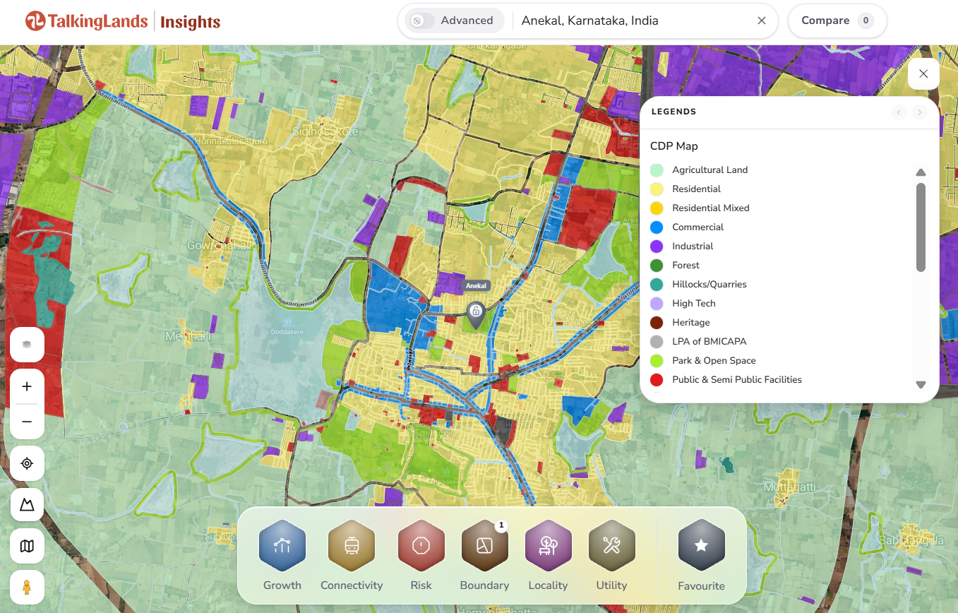
The Anekal master plan (CDP) layer seen over the map on TalkingLands Insights. Tap to open the live map.
How to check this on TalkingLands Insights
You can find your plot’s zone and planning authority in a few minutes on the map. Here is the sequence:
- 1. Search the village, locality or survey number of your plot on the TalkingLands Insights map.
- 2. Open the parcel layer to see the plot boundary and confirm you are looking at the right land.
- 3. Open the Boundary category and switch on the Master Plan layer to see the zone shown for the plot.
- 4. Switch on Planning Authority Maps to see which authority’s limits the plot falls under.
- 5. Check Risk layers such as Water Body and Flood Index to look for lake, drain or flood exposure near the plot.
- 6. Click Get Report to pull a property report, then confirm the zone and approvals with the planning authority and a lawyer before you commit.
Use the map to shortlist and to ask sharper questions. Coverage varies by area and layer, and the notified plan with the planning authority’s record is what settles the matter.
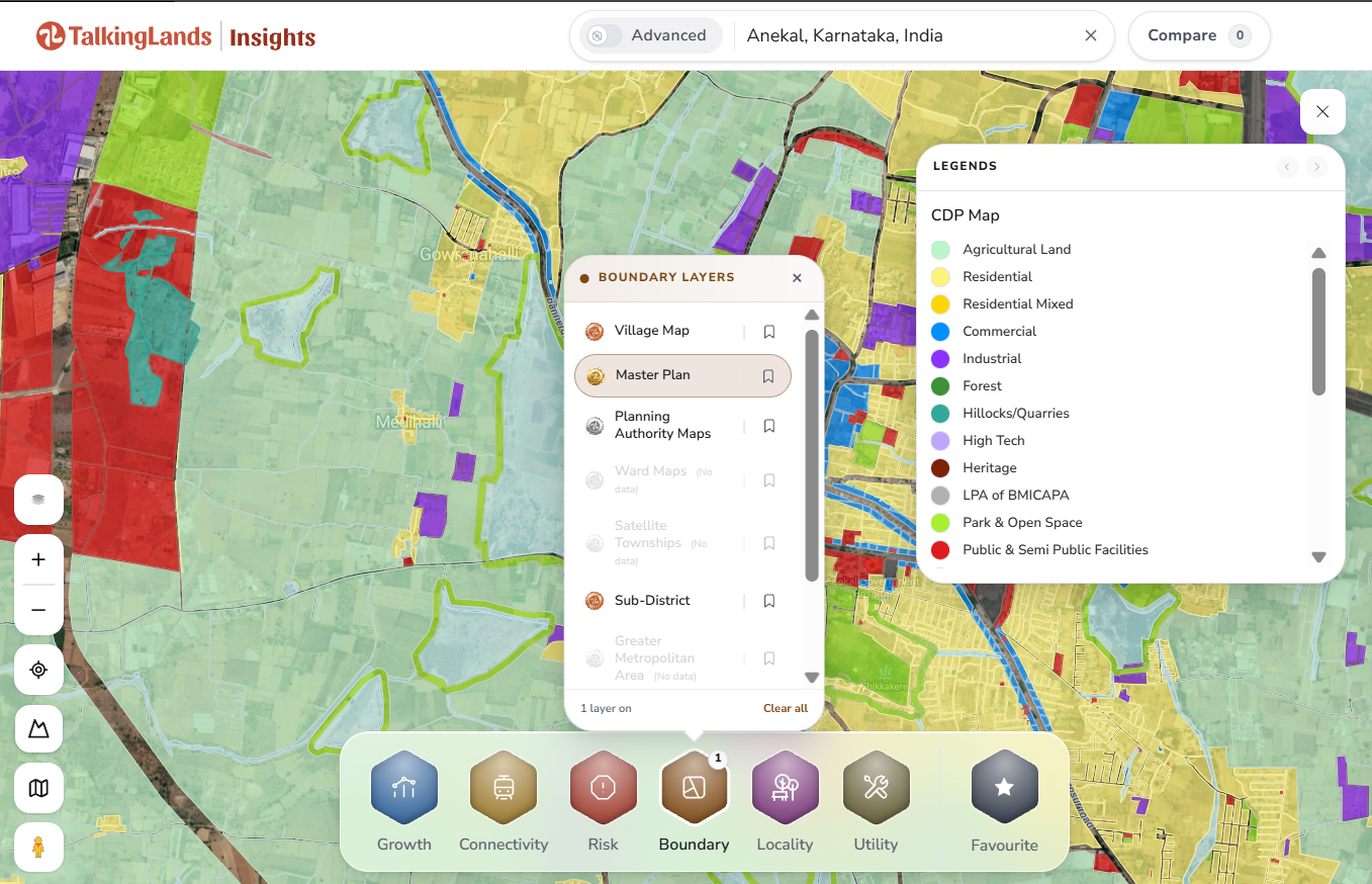
Checking a plot’s master plan zone and planning authority in Anekal on TalkingLands Insights.
What to verify beyond the map
The Anekal master plan map tells you how land is meant to be used. It does not tell you whether a specific plot is clean to buy. Before any payment, check the following on the record:
- Approved layout and plan: ask for the layout approval from the planning authority and match the site number to the sanctioned plan.
- Land conversion: confirm whether the land has been converted for non-agricultural use and that the order matches the survey number.
- Title and RTC: the master plan shows planned use, not ownership. Verify the RTC, mutation and a registered title chain with a property lawyer.
- Lake, drain and flood exposure: check buffers around water bodies and nalas, since these can restrict construction.
- Road access: confirm legal road access and the width of the road the plot fronts.
- Local body limits: confirm which body handles khata and building permissions for your village.
None of these are exotic checks, but skipping them is how buyers end up with plots they cannot build on or register smoothly.
Common mistakes buyers make
- Trusting a broker’s word on zoning instead of checking the master plan zone for the exact survey number.
- Assuming an approved layout means every rule is met without asking for the approval order, date and sanctioned plan.
- Confusing the planning district with the village and applying a general rule to a specific plot.
- Ignoring buffers around lakes and drains that may limit what can be built.
Anekal’s growth is real, and a plot in the right zone with clean approvals can be a sound purchase. Let the master plan map and the planning authority’s record turn “it looks good” into “it is verified” before you buy.
Checking a plot in Anekal?
See its master plan zone, planning authority and risk layers on one map before you decide. Sign up free and get 5,000 coins.
Check Your Plot FreeFrequently asked questions
The Anekal master plan is the statutory land-use plan for the Anekal Local Planning Area, prepared with a 2031 horizon under the Karnataka Town and Country Planning Act. It marks how land is meant to be used, such as residential, commercial, industrial, public and semi-public, agricultural or green belt, and it guides what can be built where. Check the notified plan and current amendments for the exact position on any plot.
In Karnataka, a Comprehensive Development Plan (CDP) and a master plan are commonly used for the same kind of document: a map plus zoning regulations that set land use for a planning area. When people search for the Anekal CDP map, they usually want the zone shown on the master plan for a particular survey number. Use the notified plan as the authority and a map layer only to locate the plot quickly.
Anekal falls under the Anekal Local Planning Authority, working within the Bengaluru Metropolitan Region framework overseen by BMRDA. Layout and building approvals in the area are generally handled by the local planning authority under planning rules. Confirm which body covers your village, because jurisdictions and urban local body limits can change.
Search the village or survey number on TalkingLands Insights, open the Boundary category, and switch on the Master Plan and Planning Authority Maps layers. Note the zone and authority shown for the plot, then confirm it against the notified master plan and zoning regulations with the planning authority before you buy.
No. What you can build depends on the zone, the land's conversion status, the approved layout and the building rules that apply to that zone. Agricultural or green-belt zoning, lake and drain buffers, and missing approvals can all restrict construction. Verify each of these for the specific plot.
No. The master plan shows planned land use, not ownership. Ownership and title need records such as the RTC, mutation and a registered title chain, checked by a qualified property lawyer.
No. Reporting on the master plan describes four planning districts in the area: Anekal, Sarjapura, Attibele and Jigani. A district groups many villages, so you still need to locate the individual survey number on the map.
A master plan is revised from time to time and the land-use pattern on the ground can differ from the plan. Treat the map layer as a starting point and ask the planning authority for the current notified version and any amendments that apply to your plot.
Disclaimer: This article is general information as of October 2026 and not legal or investment advice. Master plans, zoning regulations, planning limits and approvals are revised from time to time, and map coverage varies by location and layer. Verify the current information with the Anekal planning authority, BMRDA or the relevant authority and a qualified property lawyer before buying or booking.


