.png)
An investor looking at the booming Hosur Road corridor spots "cheap South Bengaluru land" near Attibele on the back of massive industrial-growth buzz. Anticipating an easy multi-fold return on their investment along this critical NH-44 stretch, they lock in the deal. Two years later, they try to secure a building plan sanction or sell the plot to a logistics company. That is when reality sets in.
The plot sits inside an agricultural green belt making it permanently unbuildable. Alternatively, they discover it is an unapproved gramathana revenue layout, or worse—it falls squarely inside an active KIADB land acquisition zone. The regional growth of the corridor was entirely real, but their specific plot was a devastating trap.
The Hosur Road Corridor connecting Bengaluru to Tamil Nadu is one of the most explosive logistics, manufacturing, and affordable residential belts in South India. But navigating the land between Bommasandra, Anekal, and Attibele requires immense spatial precision. Here is your 2026 guide to South Bengaluru’s growth engine, the genuine economic drivers pushing land values up, and exactly what you must verify before you invest.
Quick Answer: The Anekal–Attibele–Jigani–Bommasandra belt along Hosur Road (NH-44) is South Bengaluru's premier industrial and logistics growth corridor. It is driven by expansive KIADB industrial areas, manufacturing spillover from Hosur (Tamil Nadu), NH-44 highway connectivity, Bharatmala-linked corridors like the STRR, and proximity to Electronic City. However, land here is a chaotic patchwork of prime industrial zones, restricted agricultural green belts, and unauthorized Gramathana layouts. Always verify a plot's zoning, its exact corridor position, and its title before buying.
While "Hosur Road" physically starts at the central Silk Board junction, the specific industrial and logistics growth belt we are evaluating sits further south.
It is an interconnected web of manufacturing, warehousing, and residential nodes running from Bommasandra and Chandapura, expanding westward toward Jigani, moving south through Attibele and Anekal, and terminating right at the Hosur border in Tamil Nadu. This geography is defined by high-tonnage freight movement, massive factory footprints, and a booming workforce population looking for affordable housing.
Understanding the difference between hype and reality requires looking at the actual infrastructure layers anchoring the region.
(Note: TalkingLands Insights flags a Bharatmala-linked corridor—the Satellite Town Ring Road / Bengaluru–Chennai axis—near this belt. Always verify the exact, gazetted alignment before making financial commitments).
The capital flow into this corridor is driven by four very real economic pillars:
.png)
(Note: TalkingLands Insights flags a Bharatmala-linked corridor—the Satellite Town Ring Road / Bengaluru–Chennai axis—near this belt. Always verify the exact, gazetted alignment before making financial commitments).
The capital flow into this corridor is driven by four very real economic pillars:
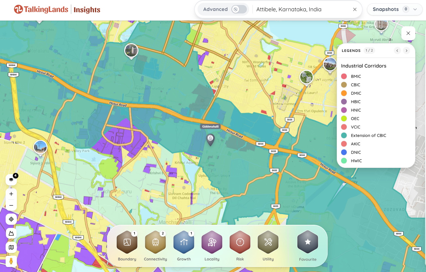
The Hosur Road corridor (NH-44) is the primary southern artery connecting Bengaluru to Tamil Nadu. The specific industrial and logistics growth belt spans the stretch from Bommasandra and Chandapura, sweeping west to Jigani, and moving straight down through Attibele and Anekal to the state border.
Yes, they represent strong investment nodes due to rapid industrial expansion, spillover demand from Hosur’s massive manufacturing ecosystem, and proximity to Electronic City. However, buyers must be highly vigilant to avoid unapproved revenue layouts and unbuildable agricultural green belts.
The corridor is anchored by massive Karnataka Industrial Areas Development Board (KIADB) estates, primarily the Bommasandra Industrial Area, the Jigani Industrial Area, and the Attibele Industrial Area, housing major biotech, automotive, and manufacturing giants.
You must verify the exact survey number against the local Comprehensive Development Plan (CDP) or Master Plan zoning maps. Using spatial intelligence platforms like TalkingLands Insights, you can overlay the plot boundary to instantly see if it falls within the restricted agricultural Green Belt zone.
Do not rely on verbal assurances. You must cross-reference your survey number against official Master Plan zoning, check the distance to major highways, confirm it is not listed in any KIADB acquisition gazette notifications, and ensure the seller holds a clear title via state revenue records.
The northern anchor of this belt connects directly to the Namma Metro Yellow Line, which terminates at Bommasandra. While an extension further south toward Attibele has been proposed by authorities, it is not an active, operational line as of 2026.



.png)

.png)
