%20(1).png)
In 2023, an investor paid a massive "alignment premium" for a 5-acre agricultural parcel near Narayangaon. The broker had assured them that the land sat directly adjacent to an upcoming station on the highly anticipated Pune–Nashik Semi High-Speed Rail corridor.
Fast forward to mid-2026: the Union Railway Minister announces that the original direct route through Narayangaon is technically unfeasible and proposes a completely different alignment routed through Ahilyanagar and Shirdi. Almost overnight, the investor's plot is wiped off the transit map. They paid a commercial premium for land that will remain firmly agricultural, far away from any upcoming transit hub.
If you are evaluating land anywhere between Pune and Nashik, the shifting alignment of this mega-project is a masterclass in the dangers of real estate speculation. Similar to the Purandar Airport land rush, buying land based on rumors or outdated maps is the fastest way to trap your capital.
Here is the factual, 2026 reality of the Pune–Nashik Semi High-Speed Rail—why the original route was challenged, what the revised alignment looks like, and why you must verify any plot against an officially gazetted alignment before you pay a premium.
Quick Answer: The Pune–Nashik Semi High-Speed Rail is a massive infrastructure initiative aiming to connect the two cities. The original plan (~235 km, speeds up to ~200 km/h, estimated at ~₹16,000 cr via MahaRail) proposed a direct route through Chakan, Narayangaon, and Sinnar. However, as of mid-2026, this original alignment has been functionally scrapped by the Centre due to critical technical conflicts with the GMRT radio-telescope facility. A revised route via Pune–Ahilyanagar–Shirdi–Nashik has been proposed, but following local protests, the original route is currently under fresh review by a state expert committee. None of these routes are officially finalized or gazetted today. Do not buy land on a speculative alignment until the final route is legally notified.
Pune and Nashik form two corners of Maharashtra’s "Golden Triangle" (alongside Mumbai). Despite their immense industrial and agricultural output, there is no direct railway line connecting them; passengers and freight currently rely on congested highways.
To bridge this gap, the Maharashtra Rail Infrastructure Development Corporation (MahaRail / MRIDC) drafted a visionary project:
Because the project's parameters have violently shifted in 2026, buyers must distinguish between the old promises and the current proposals.
.png)
The fatal flaw in the original alignment was its proximity to the Giant Metrewave Radio Telescope (GMRT) located in Khodad, near Narayangaon.
The GMRT is one of the most sensitive astrophysical observatories in the world, operating at low radio frequencies. Scientists and associated institutions raised severe objections, demonstrating that a high-speed, 25kV AC electrified railway operating nearby would generate massive electromagnetic interference, severely disrupting the observatory's radio-silence zone and crippling its scientific capabilities.
Because the original alignment was deemed technically infeasible by central authorities on these grounds, land acquisition in areas like Sangamner and Akole ground to a halt.
In mid-2026, the Union Railway Ministry officially pivoted. A revised Detailed Project Report (DPR) was announced, proposing a completely new, "greenfield" alignment.
To entirely avoid the GMRT's protected zone, the new route swings aggressively east. It proposes connecting Pune to Ahilyanagar (Ahmednagar), moving north to the massive religious tourism hub of Shirdi, and finally turning west to terminate in Nashik. While this detour increases the overall travel distance, authorities argue it opens up an entirely new economic and tourism corridor.
The Latest Review: In 2026, following objections from farmers and local representatives who want the original route restored, the state government said it would appoint an expert committee to review whether the original alignment can be saved — with a decision expected in the budget session.
Bottom line: As of late 2026, the final route is in a state of administrative limbo.
When mega-infrastructure alignments are unsettled, buying land is not investing—it is gambling. Here is why you must wait:
If you currently own land on either proposed alignment, hold it. Do not panic-sell until the final route is gazetted by the government.
If you are an investor looking to buy, do not pay an "alignment premium" on a rumor. Wait for the official gazette notification that locks the route in stone. Once the route is legally finalized, you must then verify the plot's spatial position against the notified alignment, confirm its 7/12 Extract (Satbara) ownership, and ensure it is zoned for development.
You cannot confirm if a plot is safely outside an acquisition boundary or zoned for development by trusting a broker's WhatsApp map.
With TalkingLands Insights (Pune), you can execute an honest, digital verification. Drop your Survey/Gat Number into the platform to visualize the plot on a live map. Activate the Connectivity / Semi High-Speed Rail Layer to see the mapped alignment relative to your parcel. You can simultaneously check the Draft PMRDA DP 2041 Zoning to ensure buildability, and—for covered rural villages—view the Satbara Land Parcel boundary.
(Note: Because the Pune-Nashik rail alignment is currently contested, always cross-check spatial mapping against the latest official government gazette notifications for binding authority).
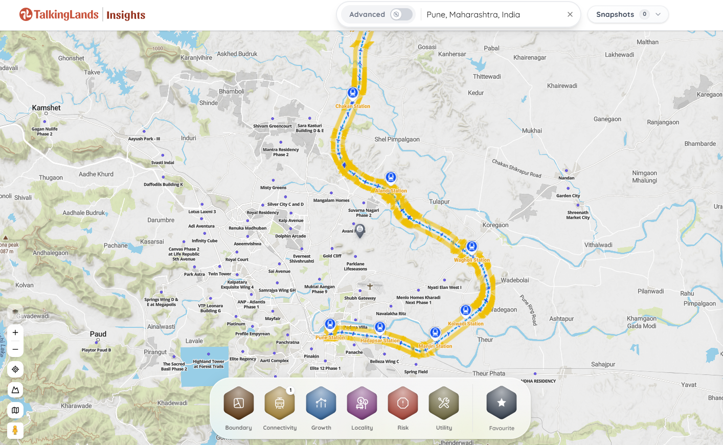
The entire project is not scrapped, but the original direct alignment (via Chakan, Narayangaon, and Sinnar) has been heavily contested by the Centre due to technical conflicts. A revised route has been proposed, and the original route is currently under fresh review by a state expert committee.
The Railway Ministry has proposed a revised, detoured alignment connecting Pune to Ahilyanagar (Ahmednagar), routing up to Shirdi, and then turning west to Nashik. This was designed to bypass the restricted radio-silence zone of the GMRT.
The original alignment passed near the Giant Metrewave Radio Telescope (GMRT) at Khodad. Scientists proved that a high-speed electrified rail line would cause severe electromagnetic interference, crippling the observatory's astrophysical research capabilities.
The project was originally spearheaded by the Maharashtra Rail Infrastructure Development Corporation (MahaRail/MRIDC), a joint venture between the State Government and the Ministry of Railways. The execution agency for the final route may involve broader Central Railway integration.
No. Because the final alignment is currently under high-level administrative review and has not been officially gazetted, buying land based on the "railway's location" is purely speculative. If the route changes, your premium evaporates. If your land falls inside the final acquisition corridor, it will be taken by the government.
You can use spatial platforms like TalkingLands Insights to overlay your Gat Number against the mapped trajectories of the various proposed alignments. However, until a final government gazette is published locking in the route, all maps should be treated as provisional.



.png)
%20(1).png)
.png)
