Purandar Airport (2026): Pune's New International Airport — Location, Status & the Areas Set to Boom
Purandar Airport (2026): Pune's New International Airport — Location, Status & the Areas Set to Boom
It is the most expensive mistake a real estate investor can make in Pune today. A buyer is pitched a 2-acre agricultural parcel in a Purandar village at a massive 40% "airport premium." The broker guarantees that because the plot is practically touching the new international airport site, it will eventually become a goldmine for logistics or hotel development.
The buyer pays the premium. A few months later, they receive an official notice: their Gat number sits exactly inside the finalized MIDC acquisition boundary. The land will be forcibly acquired by the state. The buyer will receive the statutory government compensation, but the massive commercial upside they paid the premium for has instantly evaporated.
If they had bought a plot just 1 kilometer outside that boundary, they would be sitting on a fortune.
The proposed Purandar Airport is fundamentally reshaping the real estate geography of southeastern Pune. As the project accelerates through its 2026 acquisition milestones, land values in the surrounding villages are skyrocketing. But navigating this corridor requires immense spatial precision. Here is your complete 2026 guide to Pune’s new airport, its current status, the surrounding growth corridors, and exactly how to digitally verify your plot's position before committing your capital.
Quick Answer: The Purandar Airport (officially the Chhatrapati Sambhajiraje International Airport) is Pune's proposed greenfield airport located ~40–50 km southeast of the city. To build it, the MIDC is actively acquiring ~1,217 hectares across seven villages (authorized via a Feb 2026 Government Resolution). As of mid-2026, land acquisition is aggressively underway with ~94% landowner consent. Construction is targeted to begin in 2026, with an operational target around 2027–2029. Never buy land without checking official acquisition notifications—if your plot is inside the boundary, the government will acquire it, and you cannot develop it.
What & Where Is the Purandar Airport?
Pune’s existing airport at Lohegaon has long been saturated. Because it is a Civil Enclave sharing a runway with the Indian Air Force (IAF), expanding commercial flight operations and cargo logistics is severely restricted.
To solve this, the state approved a massive greenfield international airport in the Purandar taluk, southeast of Pune city.
The Scale: Designed to handle up to ~75 million passengers annually at peak capacity, the airport will feature two parallel 4,000-meter runways capable of handling heavy international cargo and wide-body commercial jets.
The Authorities: The project is being developed by the Maharashtra Airport Development Company (MADC), while the Maharashtra Industrial Development Corporation (MIDC) handles the critical task of land acquisition.
Purandar Airport — Project at a Glance
(Note: Infrastructure statistics are based on mid-2026 administrative reports and are subject to final engineering adjustments).
Attribute
Detail
Official Name
Chhatrapati Sambhajiraje International Airport (Reported)
Location
Purandar Taluk (~40–50 km southeast of Pune city)
Executing Agencies
MADC (Development) & MIDC (Land Acquisition)
Land Area
~1,217 Hectares (~3,000 Acres) authorized
Affected Villages
7 (Reported to include Pargaon, Khanawadi, Munjawadi, Ekhatpur, Kumbharvalan, Vanpuri, and Udachiwadi)
Compensation Rate
~₹1.61 Crore per Acre (Reported via High Power Committee)
Runways / Capacity
Two 4,000m parallel runways / Up to ~75M pax/year
Operational Target
Phased opening targeted around ~2027–2029
Status & Timeline: Where Does the Project Stand?
The Purandar Airport has a long, turbulent history. Initially proposed around 2016, the project faced years of fierce political debates, shifting site alignments, and farmer protests.
However, in 2026, the project has crossed the point of no return:
The February 2026 GR: On February 9, 2026, the state government issued a critical Government Resolution (GR) officially authorizing the acquisition of ~1,217 hectares across the seven designated villages, backed by a massive ₹6,000-crore state financial guarantee.
Acquisition Progress: Backed by an aggressive compensation package of ~₹1.61 crore per acre (finalized by the High Power Committee in April 2026), landowner resistance has dissolved. As of mid-2026, a reported ~94% of landowners have given consent, with roughly 38% (~466 hectares) of the acquisition process actively underway.
The Target: The administration is targeting June 2026 to complete the bulk of the land acquisition, with civil construction slated to follow shortly after forest and environmental clearances are finalized. Barring unforeseen delays, the first phases are targeted to be operational between 2027 and 2029.
Connectivity: How It Plugs Into Pune
An airport without road access is useless. The true catalyst for surrounding real estate is how Purandar connects to the broader metropolis:
The Pune Ring Road: The eastern corridor of the MSRDC Outer Ring Road will act as the primary logistics artery, sweeping past the Purandar region and connecting the airport directly to the Mumbai-Pune Expressway and the Solapur/Ahmednagar highways.
NH-965 Upgrades: The existing Pune-Saswad-Pandharpur highway (NH-965) is being heavily upgraded to handle the immediate surge in passenger traffic.
Proposed Transit: Plans are actively being drafted for dedicated multi-modal access roads and a potential Pune Metro extension link.
Areas Set to Boom (The Investment Zones)
If you are looking to invest in airport-driven growth, you must look at the villages around (but strictly outside) the acquisition zone.
The Saswad–Purandar Belt: Saswad town and its immediate peripheries will transform into the primary commercial and hospitality anchor for the airport. This is the prime zone for hotel developers, Grade-A logistics parks, and aviation-support services.
The Southeast (SE) Pune Corridor (Hadapsar to Saswad Road): As the primary entry vector from the city, this stretch will see massive residential and high-street commercial capitalization.
Uruli Kanchan & Loni Kalbhor: Situated slightly north but heavily influenced by the intersecting Ring Road, these areas will become critical warehousing and industrial staging grounds for air-freight logistics.
The "Airport Premium" Trap (Common Mistakes)
Do not buy a plot blindly based on a broker’s "near the airport" pitch. The margins for error here are unforgiving.
Buying Inside the Acquisition Zone: If you buy land inside the notified 1,217-hectare MIDC boundary, you cannot build a hotel, a warehouse, or a residential layout. The state will acquire the land. You are effectively just trading capital for government compensation—a process fraught with bureaucratic delays.
Speculating on Unnotified Alignments: Brokers often sell plots claiming they sit on a "proposed airport access road." Until that access road is formally gazetted, you are gambling.
The PMRDA Zoning Blindness: Even if a plot sits perfectly 2 kilometers outside the airport boundary, it might be legally worthless for development. If the Draft PMRDA DP 2041 zones the land as an Agricultural Green Zone, you will never secure a residential or commercial DC Conversion.
Unapproved Gram-Panchayat Layouts: Beware of 30x40 plots being sold as "airport city layouts" on mere Gram Panchayat B-Khatas. These lack formal town planning approval and are structurally illegal.
How to Verify a Plot Before Paying the Premium
To safely capture the airport's upside, you must execute four strict spatial and legal checks:
Check the Satbara: Pull the official 7/12 Extract (Satbara) to ensure the seller owns the land and that it is free of undisclosed bank loans (Boja).
Cross-Reference Government Notifications: Check the official MIDC and Government Resolution notifications to verify your survey/gat number is not listed for compulsory acquisition.
Check the PMRDA DP 2041 Zoning: Ensure the land is officially proposed as a Residential, Commercial, or Industrial zone in the master plan.
Measure True Distance: Map the plot's actual distance from the airport site and the nearest proposed highway interchange.
Looking to Invest Near Purandar Airport?
From logistics parcels in Saswad to residential plots on the SE Pune corridor, share your exact requirements (select Pune). Our team helps you find and verify legally cleared plots outside the acquisition zone.
TalkingLands provides spatial verification and connects you with verified partners — we do not sell plots directly.
Verify the "Airport Effect" with TalkingLands Insights
You cannot guarantee a plot is safe from government acquisition by simply looking at a physical field.
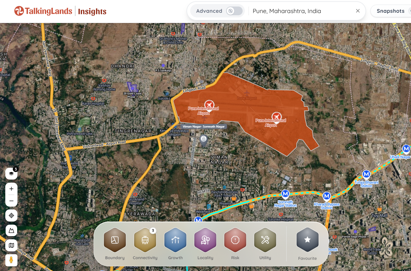
With TalkingLands Insights (Pune), you can execute a transparent digital verification. Drop your Gat Number into the platform to visualize the plot on a live map. Activate the Growth & Highways Layer to see the Purandar airport site location and the adjacent Ring Road alignment. Check the Draft PMRDA DP 2041 Zoning to ensure buildability, and—for covered rural villages—view the Satbara Land Parcel boundary. To confirm whether a plot falls inside the specific statutory acquisition boundary, cross-check the survey numbers listed in the official MIDC/GR notifications.
Frequently Asked Questions
1. Where is the new Pune international airport located?
The new greenfield airport, formally reported as the Chhatrapati Sambhajiraje International Airport, is located in the Purandar taluk, approximately 40 to 50 kilometers southeast of Pune city. It is being developed to relieve congestion at the existing Lohegaon airport.
2. What is the current status of the Purandar Airport?
As of mid-2026, the project has received critical state backing via a February 2026 Government Resolution (GR). The Maharashtra Industrial Development Corporation (MIDC) is actively acquiring ~1,217 hectares of land. With ~94% landowner consent reported and a lucrative compensation package approved, land acquisition is aggressively advancing.
3. Which villages are affected by the Purandar Airport land acquisition?
The land acquisition spans roughly ~1,217 hectares across seven villages in the Purandar taluk. The affected villages are reported to include Pargaon, Khanawadi, Munjawadi, Ekhatpur, Kumbharvalan, Vanpuri, and Udachiwadi.
4. When will the Purandar Airport be operational?
While mega-infrastructure timelines are subject to engineering and environmental clearances, the administration is targeting the completion of land acquisition by mid-2026, with civil construction to follow. Phased operational launches are currently targeted for the 2027 to 2029 window.
5. Is buying land near Purandar Airport a good investment?
Yes, provided it is executed safely. Land situated on the immediate peripheries (such as the Saswad belt) is poised for massive logistics, hospitality, and residential appreciation. However, the land must be completely outside the MIDC acquisition boundary and favorably zoned under the Draft PMRDA DP 2041.
6. How can I check if a plot is inside the airport acquisition zone?
Do not rely on verbal assurances. You must cross-reference your specific Survey/Gat Number against the official MIDC land acquisition gazette notifications. Additionally, you can enter the property's Gat Number into a spatial intelligence platform like TalkingLands Insights to map its location relative to the airport site and regional master plan.
.png)
.png)



%20(1).png)
.png)